Prickly Paths and Wet Shoes: Mt. Manalmon, Mt. Gola, and Mt. Matinik
2022 is coming to an end and looking back, it was a great year of mountaineering for the two of us. From atop the cold summit of Mt. Ulap in Benguet to the rocky peaks of Mt. Pamitinan, we have tried our best to expand the range of mountains that we can climb. But with December coming to a close, we know that we still have room for one more peak, to end the year with a bang.
The Mountains of Bulacan
We learned about Mt. Manalmon from a friend of ours who resided in Bulacan. Situated at the heart of San Miguel, Bulacan, Mt. Manalmon is a part of the vast Biak-na-Bato National Park. We initially planned to visit the area in early December but cautioned against it due to unfavorable weather at the time. It is at this time that we learned that a trilogy hike is available, which also includes Mt. Gola and Mt. Matinik. The challenge of completing three peaks attracted us. All three peaks are relatively low–Mt. Manalmon at 196 MASL, Mt. Gola at 192 MASL, and Mt. Matinik at 196 MASL–which are practically hills by some measures. But the hike would not be a leisurely walk.
Commuting to San Miguel, Bulacan
Our only option to reach our destination at the time was via bus. Thus, in the early hours of December 27, we met up at the terminal of Baliwag Transit in Cubao, Quezon City. To reach San Miguel, Bulacan, one must ride the buses with Cabanatuan or San Miguel signboards, making sure it is one of the buses that will leave NLEX at Sta. Rita exit. We hopped on a San Miguel bus and we waited for some time for the bus to fill up with passengers. We departed the terminal at around 5:05. The fare costs us Php 162.00 per passenger.
Two days after Christmas, we had hoped that it would be a quick ride for us going to Bulacan. But we are greeted with a traffic jam in the expressway. Our ride to Bulacan ended up lasting for more about two and a half hours.
We dropped off at the junction of Camias and Sibul roads. The spot would be hardly missed due to a red horse (yes, the beer one) effigy at the intersection. When unsure, you can always tell the bus conductor to drop you off at this landmark. From there we took a tricycle bound for Madlum which costs Php 250 and will take about 30 minutes of ride.
The Trilogy Hike
 |
| Madlum River near the registration area |
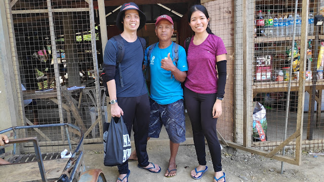
Once we were dropped off the tricycle, we found ourselves on the bank of a river seemingly in the middle of nowhere. However, after a few walks ahead and a quick question from the locals, we finally found the registration area among the huts. The nearby water was the Madlum River after all. As usual, there is an environment fee of Php 30 per person. The guide for the whole trilogy is Php 1100. It is at this point that we were introduced to Kuya Mario who would assist us for the rest of the day.
(It was later after the whole ordeal that we learned that there is also a barangay entrance of Php 20 per person.)
It was almost 8:30 in the morning when our trek for the day began. We first had to pass through the Madlum River via a bamboo raft that serves as the bridge. It is actually a private one so we had to pay another fee of Php 20 to the owner of the raft. The hanging bridge that was once used to cross the river was destroyed in the recent typhoon Karding, as evident from the remains that still hang overhead. This is just the first of the several river crossings that we will have to do in this trek.
 |
| The old bridge destroyed by Typhoon Karding |
We passed by a few houses and then a small grotto where a sign indicated to us that we were in the vicinity of the Biak-na-Bato National Park. Interestingly, a trail also includes a short section of the Madlum Cave. Kuya Mario told us that Madlum Cave itself can also be explored at a separate time.
 |
| A section of the Madlum Cave |
Boulders greet us upon exiting the cave and a few minutes later, we are again at a bank of a river. It is worth noting that the river water is clear. Indeed, some visitors would soak in the refreshing pools of the Madlum River after a day of trekking. But for now, we had to cross the river, risking wetting our climbing shoes.
Mt. Manalmon
We walked past a relatively flat plain with lush vegetation before the bamboo and shrubs thickens as we enter the base of Mt. Manalmon. There are even wild pineapples at the side of the trail sans the fruit. This is only the beginning of our encounter with spiny flora. At one point we also found a small flock of sheep grazing far from us, away from the trail and we were thrilled because this was the first time for us to see live sheep.
 |
| Sheep! |
I asked where the name Manalmon came from and Kuya Mario told us that it is a corruption of the word manlalamon (devourer). He told the story of a long time ago when a couple hunted the deer of a fairy living in the mountain. The fairy, in her wrath, cursed the couple and the earth below swallowed the couple, hence the name of the mountain.
Our slow ascent along the forest path continues until we reach the more rocky parts of the mountain, where large boulders litter. We also passed by a pair who camped for the night in the mountain before we finally saw the beginning of the summit once the block stone cap of the mountain appeared. The rock is eroded evenly so a rope that is already set up would be needed to climb up. Once atop, we noticed markings along the edges which serves a safety line–past this line would be perilous. It is already 9:20.
We were lucky it was not a sunny day, because there wasn't any vegetation nor trees at the summit given the solid rock where we stood. All the more lucky because it helped us enjoy the view that surrounds us.
It was green and mountainous all around. At the bottom, we could see the length of the Madlum River while over the horizon, we could see the other mountains of Bulacan including the next two peaks that we will ascend, as well as Mt. Mabio in Dona Remedios Trinidad, and even Mt. Arayat in the province of Pampanga.
We had some refreshments for a bit at the top while we took in the view. One summit down.
Afterwards, we began our descent until we reached a store at the base of Mt. Manalmon which sells food items as well as refrigerator magnets for souvenir. There we had a quick breakfast while being watched by a little furry ball.
At 10:20 in the morning, we set on to continue our journey. Mt. Manalmon and Mt. Gola, our next target, is separated by the Madlum River, thus we have to cross the water again. Kuya Mario mentions that hiking during heavy rains is not advisable as Madlum River could overflow. In fact, Madlum River has been in the news back in 2014, when a tragedy at this location cost the life of several Bulacan State University students.
Upon crossing the river, it is evident how dangerous the river can be. Debris, mostly bamboo and tree branches, carried during the previous typhoon Karding litter the banks even as far as 50 meters from the waters—a grim reminder of what nature can do when it decides to let its floodgates open.
Mt. Gola
The trek at the base of Mt. Gola begins with a guided rope walk. Again asking our guide where the name Gola came from, he told us that it is shortened from tanggulan (defense camp) since back in World War II, the mountains served as a camp for guerilla forces fighting the Japanese. Several minutes later, we came upon the more rocky parts which upon closer are littered blue-green stones and most noticeable on chipped rocks. These reminded us of the blue hills of Sagada that we visited several years ago.
The rocky trail continued until we finally reached the peak of Mt. Gola at 11:10.
The view would still be the same but we still took our time taking pictures and had a bit of rest.
Mt. Matinik
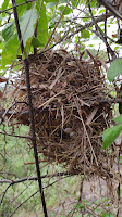
The final part of the trek begins as we went down from Mt. Gola and started the trip to Mt. Matinik. Once again, we walked past the bushes going up the last peak. At one point Kuya Mario pointed to us a nest of possibly a pipit bird which already contains a couple of eggs. As we continued on, it became obvious why Mt. Matinik (thorny) is named as such. We had to be more careful of the plants that brush our limbs and the slightest pricks can still penetrate our arm sleeves.
The cautious trek continued until we reached the final summit of this trilogy landing our feet on the rocky caps typical of the other peaks. It was already 12:22 in the afternoon but thankfully, the gray clouds still hid the noon sun from us. We were glad that we completed our goal and what had been the 13th summit that we had for 2022.
However, our trial does not end here as we began our descent. It is becoming more apparent that Mt. Matinik earned her name as more prickly bushes scratched us, adding to that the burrs of the several plants that kept on sticking on our clothes that removing them becomes futile as the trek down continues.
Finally, our worries ended as Madlum River finally appeared in the distance. We made the crossing, this time on flip flops. Madlum Cave came next until we finally reached the raft/bridge crossing at the beginning of our trail. It was almost 2:30 in the afternoon when we got back to our starting point.
Wrapping Up
At first we were worried how we would go back to town but Kuya Mario was generous enough to give us a ride on his tricycle up to the barangay entrance (where we paid the entrance fee as we were leaving, ironically). With his help we were able to transfer to another tricycle which took us to the Baliwag bus terminal downtown.
Overall, the Bulacan trilogy is a great experience for us. The trek was not that difficult but it still made us experience many things at once–caving, river crossing, some encounters with wildlife, and nature at its finest. It’s a trip that I may look forward to doing again, barring a thorn prick or two.


Comments
Post a Comment